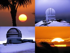
 Hawai_Compo4 (Photo credit: StarObs)
 CMc IB RF06 C130 02 (Photo credit: Wikipedia)
 Plot of water column height as measured by NOAA's National Data Buoy Center DART buoy 34142, located 630 NM southwest of Lima, Peru. The buoy shows the passage of the tsunami generated by the 2010 Chile earthquake. (Photo credit: Wikipedia)
 Hawai (Photo credit: tellda)
 The calm before a virtual tsunami with a DART buoy in the foreground. (Photo credit: Wikipedia)
 Launch of the U.S. Navy-constructed R/V Kilo Moana, the newest oceanographic research vessel, at a ceremony in Jacksonville, Florida on November 17, 2001. The Kilo Moana is an AGOR26 swath ship that will be operated by the University of Hawaii. After completion of sea trials, NSF will fund research using the vessel in the latter half of 2002. Photo courtesy of Naval Sea Systems Command. (Photo credit: Wikipedia)
 A stern (rear) view of the ship. Note the large green A-frame on the deck that is used to deploy and recover oceanographic instruments and gear. (Photo credit: Wikipedia)
 Diagram of the Deep-ocean Assessment and Reporting of Tsunamis (DART) II buoy. (Photo credit: Wikipedia)
 Seal of the University of Hawai i System (Photo credit: Wikipedia)
 P5 uw01 (Photo credit: Wikipedia)
 Image via CrunchBase
This page was generated by Opera from http://feeds.feedburner.com/RaisingIslands
Look for RSS reports on Netvibes
One thing about blogging with Opera is that links have to be manually re-inserted ; time consuming, but very clean of extraneous baggage. It doesn't seem to 'load up' as quickly as Firefox...which tends to fail by freezing. Of course, Copy and Paste operations done wholesale the way I do in Firefox or Google Chrome ( which doesn't always upload ) is impractical.
One could load Mozilla's reader into Opera....but that would defeat the purpose of selecting against Java. Zemanta was added in Firefox.
opera:private
RAISING ISLANDS
Ships at sea could warn of tsunami: UH/PTWC researchers
May-07-12 11:38:00 AM
Jan T
Undersea sensors are a key tool to measuring tsunami traveling toward Hawai`i, but University of Hawai`i researchers found they are able to detect tsunami from on board ships. Could that lead to critical new warning data from the hundreds of commercial ships regularly plying the Pacific? That’s possible, according to a study published this month. (Image: The University of Hawaii research vessel Kilo Moana, which was at sea during the February 2010 Chile earthquake, and which was able to detect the tsunami as it passed under the ship. The Kilo Moana was underway between Hawai`i and Guam. Credit: SOEST/UHM.) The study , published in the American Geophysical Union’s Geophysical Research Letters, was written by researchers from the University of Hawai`i’s School of Ocean and Earth Science and Technology (SOEST) and the National Oceanic and Atmospheric Administration’s Pacific Tsunami Warning Center. The lead author is James Foster, an assistant researcher at SOEST. Co-authors are Benjamin A. Brooks, Glenn S. Carter and Mark A. Merrifield of SOEST and Dailin Wang of the Pacific Tsunami Warning Center. Kilo Moana was at sea when the magnitude 8.8 quake occurred. The ship was equipped with highly sensitive geodetic GPS technology. Tsunami waves are generally believed to be undetectable from ships in the deep sea, but can build and be intensely destructive as they move into shallow waters. When the Chile quake’s tsunami passed under the ship, it was only 4 inches high—smaller than the normal ocean waves. But a tsunami has a characteristic extremely long wavelength. Data collected on the ship was able to pull out of the background movement the change in sea surface height caused by the wave. “Our discovery indicates that the vast fleet of commercial ships traveling the ocean each day could become a network of accurate tsunami sensors,” Foster said. The current best technologies for determining the strength of an underway tsunami are their appearance on automated tide gauges on islands that lie midway along their paths, and an array of deep ocean pressure sensing DART systems. The DART array is problematic since they are very expensive and difficult to maintain. SOEST in a news release said the DART installation between Hawai`i and Chile at the time of the tsunami was out of order, as was 30 percent of the entire network. Said Foster: “If we could equip some fraction of the shipping fleet with high-accuracy GPS and satellite communications, we could construct a dense, low-cost tsunami sensing network that would improve our detection and predictions of tsunamis -- saving lives and money." He and fellow researchers at UH SOEST plan to install systems on a couple of ships, to begin collecting data, and to see whether these systems can, in fact, save lives and property, as well as cash. The report details: GEOPHYSICAL RESEARCH LETTERS, VOL. 39, L09603, 4 PP., 2012 doi:10.1029/2012GL051367 © Jan TenBruggencate 2012
Earth may have many moons: UH Institute for AstronomyApril-16-12 3:09:00 PM
Jan T
At any given time, astronomers now estimate our moon has at least one companion—a much smaller second moon in orbit around Earth. Only one of these moons has thus far been detected, but theoretical astronomy suggests that asteroids slip into Earth orbit comparatively frequently, but then spin back into space as the complex gravities of the Sun, the Moon and Earth jerk it this way and that. (Image: The line drawing is the simulated orbit of a mini-moon. The photo is an asteroid that shows what such a moon might look like—oddly shaped with pockmarks from impacts with other objects. Credit: K. Teramura, University of Hawai`i Institute for Astronomy.) Researchers from the University of Hawai`i Institute for Astronomy, the University of Helsinki and the Paris Observatory recently published their work, “ The population of natural Earth satellites ,” in the journal “Icarus.” The authors are Mikael Granvik, Jeremie Vaubaillon, and Robert Jedicke. A news release on the report is here . Each off these temporary moons is thought to be not much more than three feet across, and they may stay in orbit for on average less than a year, although some could remain in orbit around the Earth for much longer, perhaps even decades. Only one has ever been actually detected. That was in 2006, when the University of Arizona’s Catalina Sky Survey discovered one it called 2006 RH120. The asteroid was about the size of an automobile and it returned to solar orbit after spinning around our planet for several months. The scientists used a supercomputer to do a massive calculation of the orbits of 10 million asteroids that pass near the Earth, and concluded that at any given time, at least one of them would be in Earth orbit, generally following a wildly twisting path, caused by the competing gravities of the larger objects in our solar system. © Jan TenBruggencate 2011
Wild life in the Hawaiian deep: new photo archive
March-27-12 12:14:00 PM
Jan T
When you get down into the deep ocean, it’s not just more of the same. The creatures of the deep are different—so different that some don’t even look like creatures. (Images: A couple of shots from the Hawai`i Undersea Research Laboratory deep sea creature collection include the outrageously spiky crab Lethodidae neolithodes and the impressively patterned starfish Pentaceraster cumingi . Credit: HURL.) To help understand the amazing diversity of deep ocean life around the Islands, the Hawai`i Undersea Research Laboratory (HURL), which has been photographing them f or more than 30 years, has created an online identification guide. The resource was once access-limited to scientists—it is loaded onto iPads that submersible staffs can take along for critter identification--but is now publicly available, here . You’ll find there more than 1,500 images, some of them still shots and others taken from videos, that have been collected during deep dives by the University of Hawai`i’s various manned and remotely operated submersibles. A press release with more details on the program is available here . © Jan TenBruggencate 2012
Mercury and Venus used to gauge the Sun
March-21-12 3:57:00 PM
Jan T
Captain James Cook more than two and a quarter centuries ago voyaged to Tahiti to view the transit of Venus across the face of the sun, in attempt to gauge the size of the solar system. There is a cool NASA article about that here . (Image: Images of Mercury’s path across the face of the sun, as viewed from NASA’s Solar and Heliospheric Observatory (SOHO) on November 8, 2006. Credit: NASA.) Scientists are still doing that kind of seminal work, and researchers from Hawai`i, Brazil and California have just announced that the 2003 and 2006 transits of Mercury across the sun, measured from the SOHO satellite, have yielded the most accurate ever calculation of our sun’s size. The radius of the sun is 432,687 miles, give or take 40 miles, they say. Using a satellite gave the researchers a great advantage over Cook, since they could overcome the blurring caused by the Earth’s atmosphere. The researchers included Jeff Kuhn and Isabelle Scholl of the University of Hawai`i Institute for Astronomy, Brazilian astronomer Marcelo Emilio, who was visiting the Hawai`i institute, and Rock Bush of Stanford University. And while they used Mercury for the latest measurement, they plan to observe the transit of Venus June 5, in an attempt to improve the accuracy of their measurement even more. Their paper on the work is here . © Jan TenBruggencate 2012
Wave energy potential massive for Hawai`i, but...
March-17-12 1:31:00 PM
Jan T
Forget land-based electricity sources like geothermal, wind and solar—the Electric Power Research Institute says Hawai`i could easily produce all its power from waves. Its new study , “Mapping and Assessment of the United States Ocean Wave Energy Resource,” the agency says Hawai’i has the potential to produce 130 theoretical terawatt-hours of power annually from wave energy. And 80 terawatt-hours annually of actually recoverable power. The report was prepared for EPRI by the Virginia Tech Advanced Research Institute and the National Renewable Energy Laboratory. There remain significant issues for wave energy, including that there’s no robust wave energy collection technology that yet has a long history of actual energy production. There are, however, many companies with some really interesting technological approaches. This 2009 report from the Hawai`i Clean Energy Initiative doesn’t even list wave power as a renewable energy source. One of the issues for Hawai`i is that the system that’s going to work may not be one that requires waves come reliably from a single direction. Says the report: “The Hawaii region experiences a greater vaiety of orientations and prevailing wave directions than the US mainland West Coast...” And there’s the whole issue of whether wave energy in a particular location, even though it is “technically recoverable,” is actually something in a place you’d want to have a wave generation unit. And there’s the question of how quickly wave energy can become a part of our energy mix. If you go to this U.S. Energy Information Service Administration website , you find an estimate that Hawaii was expected to have 2.7 megawatts of wave energy production in place by the end of last year. Hopeful forecasts are rampant in the energy field, and this appears to have been another. Still, there’s a lot of theoretical potential in wave energy. Total installed capacity of all the utilities in Hawai`i today is between 2 and 3,000 megawatts. If all of that were producing at 100 percent all the time, it would produce on the order of 20 terawatt-hours—a fraction of the 80 terawatt capacity EPRI says is possible from waves alone. © Jan TenBruggencate 2012
Crown of Thorns starfish invasions are local, not alien
March-08-12 1:32:00 PM
Jan T
When crown-of-thorns starfish invade a reef in numbers, the results are devastating. It’s been assumed that they show up like alien invaders, their larvae washing in from elsewhere and taking rapacious advantage of a virgin reef. But new evidence suggests that’s not the case. (Image: A line of crown-of-thorns starfish grazing on a reef. Credit: Molly Timmers, NOAA.) The new genetic work shows that most outbreaks seem to be sourced in the native starfish population—that perhaps something has changed in their environments to suddenly give them a massive opportunity to burgeon. As Walt Kelly wrote for Pogo, “We have met the enemy and he is us.” A copy of the new research is available here . The paper was written by Molly A. Timmers of NOAA’s Pacific Islands Fisheries Science Center, Chris Bird, Rob Toonen and Derek Skillings of the Hawai`i Institute of Marine Biology at the University of Hawai`i, and Peter Smouse of Rutgers University’s Department of Ecology, Evolution and Natural Resources. Crown-of-thorns sea stars, Acanthaster planci , are notorious for their massive population explosions. They eat vast amounts of live coral, changing the very character of the reef, promoting seaweed growth, changing fish populations and creating cascades of changes. In Hawai`i, outbreaks have been attacked by divers with toxic syringes, injecting individual animals. In Australia’s Great Barrier Reef, outbreaks often occur in vast waves, working their ways down the length of the reef. The team of scientists conducted genetic tests on the sea stars, only to find that they tended to be home-grown, not outsiders, “This research has proved that outbreaks are not some rogue population that expands and ravages across central Pacific reefs. Instead, the authors hypothesize that nutrient inputs and favorable climatic and ecological conditions likely fuel outbreaks of local populations,” said a press release from the University of Hawai`i . Why is this information useful? Because a lot of the response to the outbreaks tends to focus on killing the starfish themselves rather than attacking the cause of the population increase, “This study is the first genetic survey of (crown-of-thorns) populations in which both outbreak and non-outbreak populations are surveyed across a broad region of the Pacific and the results are pretty clear that outbreaks are not jumping across large expanses of open ocean,” the release said. The paper itself concludes: “Overall, outbreaks that occur at similar times across population partitions are genetically independent and likely due to nutrient inputs and similar climatic and ecological conditions that conspire to fuel plankton blooms.” In plainer English, co-author Rob Toonen, of the Hawai‘i Institute of Marine Biology, said, “Our recommendation to managers is to seriously consider the role that environmental conditions and local nutrient inputs play in driving (crown-of-thorns) outbreaks,” said © Jan TenBruggencate 2012
In Hawai`i we live long, but like elderly everywhere, we're dying faster
February-06-12 1:38:00 PM
Jan T
Hawai`i leads the nation in longevity, and new research suggests our old-timers are in fact dying faster than theory suggests--and at the same increasing rate as the rest of us. The new information is contrary to the long-held belief that the mortality curve flattens after age 80. This has significant impacts everywhere, and particularly in a state like Hawai`i, with its high elderly population—and the need to plan for providing services to an elderly population. Only eight states have residents who can expect, on average to live past 80. Hawai’i is at the top of the list at nearly 81.5 years. The others over octogenarian status are, in order after Hawai`i, Minnesota, California, New York, Connecticut, Massachusetts, North Dakota and Utah. The national average in 2010 was 78.3 . If you’re interested in this sort of data, you might want to look here and here . It was nearly two centuries ago, in 1825, that a fellow named Benjamin Gompertz calculated that an adult person’s chance of dying in any given year doubled with every added eight years of life. His calculation estimates your chances at about 1 in 100 at age 60, but 1 in 10 by the early 80s. Researchers quickly found fault with the law, with respect to the very old. And they developed something called the late-life mortality deceleration law. It suggests that your chances of dying don’t keep increasing so quickly beyond age 80—that mortality rates flatten out. But scientists Leonid A. Gavrilov and Natalia S. Gavrilova, writing in the North American Actuarial Journal , say they compared that theory against the actual data of more than 9 million Americans born during the 20 years from 1875 to 1895. What they found was that there are far fewer oldsters than most folks expected—just half as many. Making it to 100 years of age turned out to be twice as rare as the U.S. Census has assumed. “Study of several single-year extinct birth cohorts shows that mortality trajectory at advanced ages follows the Gompertz law up to the ages of 102-105 years without noticeable deceleration,” the authors write. Or, put more simply: “In our study, we found no significant mortality deceleration at advanced age for humans.” (Interestingly, the superannuation mortality deceleration still holds for insects, but that's another tale.) The development of the flawed mortality flattening or deceleration theory likely was the result of any number of factors, including mixing birth cohorts, age exaggeration and various other errors, they say. The findings have serious impacts. All kinds of calculations are based on the assumption of how many elderly will be alive, and how fast they’re dying: retirement planning, annuities, insurance policies, Social Security payments, care home cost projections, an entire range of health care numbers, and lots more. © Jan TenBruggencate 2012
Tracking the great Japan tsunami debris field: wood blocks and satellitesJanuary-26-12 7:17:00 PM
Jan T
In order to better understand the flow of marine debris from the Japan tsunami last year, a team of researchers is using...marine debris. That is, they have deposited near the leading edge of the debris field a series of satellite-reporting buoys and hundreds of wooden blocks imprinted with a website address and phone number, where beachcombers and boaters who find them can report their location. (Image: One of the wooden blocks. If you find one, please report where you located it. The address to use is hilodrifter@gmail.com . Credit: IPRC.) The preliminary data from the program is indicating that the debris currently is flowing west-to-east somewhat north of the Northwestern Hawaiian Islands, and thus far has not started coming ashore. More on that at the end of this report. The marine debris survey is designed to help better understand the likely impacts of the millions of tons of material that was washed into the sea by the March 11, 2011, earthquake and tsunami in Japan. “One thing is certain: the debris is hazardous to navigation, marine life, and when washed ashore, to coastlines,” said a press release from the International Pacific Research Center at the University of Hawai`i. Researchers thus far have largely depended on already deployed floaters and computer current and wind models to make estimates of the debris field’s location. They’ve been helped by reports from a few ships that have transited the field. The models suggested that debris could be arriving in the Northwestern Hawaiian Islands this winter, hitting Midway Atoll and the islands of the Papah ā naumoku ā kea National Marine Monument. Ship reports as early as September showed the debris field just 250 miles northwest of Midway. Teams from the University of Hawai`i at M ā noa and at Hilo, the Scripps Institution of Oceanography and the Ocean Recovery Alliance, developed a plan to deploy a drifter array across the front of the debris field. They developed 11 satellite-tracked buoys that are designed to mimic the motion of different kinds of debris, and put them in the water between Midway and the debris field. The satellite signals from the buoys will help researchers understand how the field is moving in the local currents of the region. In a decidedly lower-tech program, they also deployed 400 wooden blocks in the water, each branded with information on how people finding them can respond. “If boaters, fishermen and beachgoers find these blocks and contact the scientists by the information on the blocks, they will also increase understanding of the motion of debris and currents in this remote region,” the release said. It added: “Among the most important results of the expedition was the recognition that tsunami debris has recently not advanced towards Midway, but instead has been flowing eastward well to the north of the atolls. “Analysis of the ocean-current field shows why: For the past weeks, the general flow around all Hawaiian Islands has been from the southwest, producing a front located 300-400 miles northwest of the Midway. This front and associated northeastward jet keep the tsunami debris north of the islands...at least for the time being.” Learn more about the debris tracking project here. http://www.oceanrecov.org/tsunami-debris/about.html The researchers on the project are Nikolai Maximenko and Jan Hafner of IPRC, Doug Woodring of Ocean Recovery, Luc a Centurioni of Scripps Institution of Oceanography and Hank Carson of the University of Hawai`i at Hilo. © Jan TenBruggencate 2012
Mauna Kea: in Kamehameha's time, it was always white
January-19-12 12:26:00 PM
Jan T
It’s news when the first winter snow falls on Mauna Kea—news because it’s not always snowy up there. But an intriguing new book on the volcano’s sister mountain, Mauna Loa, suggested that as little as 200 years ago, it WAS always snowy up there. (Image: Winter snow on Mauna Kea, February 1971. Credit: Donald A. Swanson, USGS.) Mauna Loa and the Mauna Loa Observatory get credit for being major players in the understanding of climate change, but Mauna Kea may also have a role to play. During the lifetime of Kamehameha I, according to one of Kamehameha’s confidants, Mauna Kea was perpetually covered with snow. In this period before the Industrial Revolution and the dumping of carbon dioxide from fossil fuels into the atmosphere, this little bit of Hawaiian anecdotal history would suggest the climate was, indeed, cooler. The book, by Forrest M. Mims III, is Hawai`i’s Mauna Loa Observatory: Fifty Years of Monitoring the Atmosphere , just published by the University of Hawai`i Press. Mims, a prolific technology writer, is the co-founder of the firm that developed the Altair 8800, the first kit microcomputer. Bill Gates helped write the software that ran it; Steve Jobs cut his teeth on it as Apple was being developed. Mims writes a detailed history of the mountain and of the observatory that made it famous in climate circles. It was there, up on the shoulder of Mauna Loa, that Charles David Keeling began in 1958 taking measurements of the amount of carbon dioxide in the atmosphere. The record of those continuing measurements, known as the Keeling Curve, show the steady and continuing buildup of CO2, largely the result of humanity’s burning of fossil fuels.( I'd like to see the citation definitely establishing that one. The IPCC need not apply. ) Keeling was just one of many brilliant scientists who used the unique site for atmospheric and other research, and the book covers all of them in a readable way that puts meat on the bones of one of Hawai`i’s premier scientific research sites—one of worldwide importance. But a little piece of information early in the book is both interesting and telling. In the early 1800s, when explorer-scientists were still bleeding from lava cuts, puking from elevation sickness and generally risking their lives to climb these mountains, one of the researchers in the Islands was the Scottish botanist James Macrae, who arrived in 1825 with Lord Byron on the HMS Blonde. Macrae never climbed the mountains, but reports, almost as an afterthought, a conversation with old-timer John Young: “During the 26 years that Mr. Young has been on the island, he has never seen Mouna Kaah (Mauna Kea) free from snow, but has not seen snow on Mouna Roah (Mauna Loa) in summer, and on this he bases his theory of the greater height of Mouna Kaah.” John Young was left on Hawai`i by the British ship Eleanora in 1790. An exceedingly important Western advisor to Kamehameha, Young was known to Hawaiians as Olohana. He built ships for the king, and commanded the king’s cannons during war. He later became Kamehameha’s governor of Hawai`i Island. Macrae was on the Big Island in May, and reported in his diary that he clearly saw snow on Mauna Kea. While Macrae was more interested in the snow as an indication of elevation, Mims recognized that the report was “an intriguing observation about the climate of Hawai’i two centuries ago.” The late 1700s and early 1800s were the tail end of a climate period commonly known as the Little Ice Age. And the perpetual snow also accounts, of course, for the name: Mauna Kea, White Mountain. For more on Mauna Kea, see the Hawaiian Volcano Observatory page on the mountain. For more on Mims’ book, see this University of Hawai`i Press site . The publisher writes: “ Hawai‘i’s Mauna Loa Observatory should be read by atmospheric science students to gain an appreciation for the enormous effort required to generate high quality data. Much more than a strict scientific biography of Mauna Loa, this work will also be appreciated by anyone interested in a highly accessible history of the human side of atmospheric observations at a remote, high-altitude observatory.” © Jan TenBruggencate 2012
Global food crisis: How Hawai`i responds
January-12-12 12:28:00 PM
Jan T
The possibility of a global food shortage is just one of the arguments in favor of locally produced food. Several new data points suggest that such shortages are looming. How does one respond? Support local farmers. Grow your own garden. And pay attention to what it takes to feed you. (Image: Locally grown jabong, a cousin to oranges and grapefruits, known to science as Citrus grandis .) There are multiple benefits of addressing the local food issue, not the least being that you know what you’re eating and what’s gone into it. More on that later. First, some food shortage data points. The Consumer Price Index indicates that the cost of food is rising faster than the rest of the economy. (So is energy which, of course, is needed to ship food to us.) And this isn’t just an inflationary trend at restaurants. The cost of food eaten at home has gone up much faster than food eaten out. Here’s now the Bureau of Labor Statistics folks phrased it: “The index for food at home has risen 5.9 percent over the past year with all six major grocery store food groups up at least 4.4 percent.” Not counting food and energy, the 12- month general inflationary number was half that, at 2.2 percent. (These numbers are for November 2011, the most recent ones available. December’s numbers are due out in a couple of days.) Why are the numbers going up? Perhaps because we’re not keeping up with demand. In 2011, the world produced record grain crops, and still, worldwide supplies of grains fell . Supply has failed to match demand in seven of the last 12 years. Global grain stores, according to that source, are at 75 days. In the 80s and 90s, they averaged nearer 100 days. “In 2006, stocks bottomed out at 62 days, setting the stage for the 2007—08 food price spike when international grain prices doubled or tripled in a short amount of time.” wrote Janet Larsen of IPS/Earth Policy Institute, in an article this week. There’s plenty of apocalyptic prediction out there. Even as staid a publication as Scientific American in 2009 asked, “Could Food Shortages Bring Down Civilization?” In some parts of the world, the crisis is already underway. So what does that mean in terms of Hawai`i? There’s the likelihood that feeding ourselves will be much more expensive, and the possibility that some foods won’t be available or at least won’t be affordable for some of us. There are multiple initiatives in the Islands that provide responses. The Slow Food movement is one. It supports diverse, locally produced foods. Foodcapes Hawai`i talks about edible landscapes and growing at least some of your food at home. Food security is a focus of Hawaii Homegrown Food Abundance , and its website is a nice tutorial on why it’s important and how to go about growing it. The site has a bunch of useful links. The state is replete with organizations like M ā lama Kaua`i , which supports food sustainability and works for “relocalizing our food, energy, goods an services.” One nice challenge: eat a meal now and then that includes only locally grown food, and none that comes from off your island. © Jan TenBruggencate 2012
( No mention is made of the Green Revolution and Monsanto's poisoning of our food supply even though Hawai'i is home* to Monsanto research farms
*When GE papaya was introduced 5 years ago they claimed it was a 'solution' to the papaya ringspot virus problem. But instead it has caused serious environmental and economic problems for farmers)
A solution to honeybee Colony Collapse Disorder? Doubt it.
January-05-12 11:07:00 AM
Jan T
The world’s honeybees are suffering from a disastrous ailment—millions of bees are suddenly failing to return to their hives. Some beekeepers have lost more than half their hives. Hawai`i beekeepers are also suffering with an array of intractable threats to their bee colonies. Dozens of researchers have “solved” the problem. Don’t believe them. Nobody yet knows for sure what’s causing the mysterious Colony Collapse Disorder. And, one tip—don’t trust the headlines that suggest someone does. The latest culprit in CCD is a parasitic fly, whose larvae get into bees and confuse them—causing them to lose their way home. Some headlines are categorical. Here’s one : Parasitic Fly to Blame for Honeybee Population Decline . Maybe. But then there was the report that Colony Collapse bees have different genetic makeups from regular bees. And perhaps it’s a new class of nicotine-based pesticides, which is outlined in the movie, “Nicotine Bees.” The neonicotinoid pesticide theory has this intriguing bit: When Italy banned the nicotinoid pesticides, its bees reportedly started to recover: “In 2009, Italy's neonicotinoid-free corn sowing resulted in no cases of widespread bee mortality in apiaries around the crops. This had not happened since 1999. The European Research Center, Youris, reported that Moreno Greatti, from the University of Udine stated, `Bee hives have not suffered depopulation and mortality coinciding with maize sowing this year. Beekeepers from Northern Italy and all over the country are unanimous in recognizing that the suspension of neonicotinoid- and fipronil-coated maize seeds.’” That’s from TreeHugger . Some suggest CCD is the result of poor management by beekeepers, but that wouldn’t explain why unmanaged wild bee hives have gone virtually extinct in many parts of the world. Some folks blame cell phones—a theory that apparently originated from a German study of whether cordless phones could impact bee learning. The author of the study itself says there’s no connection to colony collapse disorder: "If the Americans are looking for an explanation for colony collapse disorder, perhaps they should look at herbicides, pesticides and they should especially think about genetically modified crops," said Stefan Kimmel, who co-authored the German study, in a New York Times report . Kimmel emailed Associated Press to further assert that there is “no link between our tiny little study and the CCD-phenomenon ... anything else said or written is a lie." Then there are the predations by varroa mites, nosema disease, tracheal mites or even a combination of all of these things. A University of Florida Extension Service scientific report has a pretty evenhanded review of the problem. The upshot right now is that there’s a lot of research going on, there are tons of theories, and there are no definitive answers. And if anyone claims to have one, be suspicious. © Jan TenBruggencate 2012
( Reads AP for source material. That could be part of the reason why nothing has been found ! )
No joy in recent reports on climate future for Hawai`i
January-04-12 6:14:00 PM
Jan T
There is no current scenario that looks good for Hawai`i when you study climate and energy. A quick start-of-the-year review of the most recent research on energy use, climate change, and sea levels makes one long for the days when we still had the opportunity to do something about what’s coming. The International Energy Agency’s recent global energy report said this: “`If we don’t change direction soon, we’ll end up where we’re heading’... There are few signs that the urgently needed change in direction in global energy trends is underway.” Oil prices bounced around in the $30 range from the late 1980s to the late 90s, and then began an inexorable climb. Prices broke through the $40s in the first third of the century’s opening decade, the $60s in the second third, and around the $80s late in the decade, with a burst to near $150 a couple of years ago. It was bouncing around $100 in recent months. Why has it been rising? Could it be because world energy demand is climbing just as inexorably? World primary energy demand was about 9,000 Mtoe in 1990. (Mtoe: That’s million tonnes of oil equivalent.) The demand passed 10,000 Mtoe by 2000, passed 11,000 Mtoe before 2005 and was more than 12,000 Mtoe by 2010. And it’s still apparently rising. That’s all from the International Energy Agency’s* (IEA) World Energy Outlook 2010 . The IEA just released their 2011 outlook. It views things as worse, not better. It’s worse in part because even at $100 a barrel, fossil fuels in many countries are subsidized, so in comparison to its real cost, it’s still cheap. What do you do? The 2010 IEA World Energy Outlook said this: “Getting the prices right, by phasing-out fossil-fuel subsidies, is the single most effective measure to cut energy demand.” But in 2010, according to the executive summary of the 2011 report , “Subsidies that encourage wasteful consumption of fossil fuels jumped to over $400 billion.” What does all this mean, besides high-cost energy, international restiveness, and economic malaise? Of course, because high oil and coal consumption dump carbon dioxide into the atmosphere, it means that climate change, already evident around the globe, gets worse. A few years ago, folks were talking about maybe enacting strict policies that might keep global temperature rise to 2 degrees Centigrade. Virtually nobody did what was needed. “The door to 2 ° C is closing,” the 2011 IEA report says. And without significant new policies around the globe, it’s on track to 6 ° C, it says. What’s that mean for the Islands? For the bad news check out the University of Hawai`i Coastal Geology program’s sea level website . It means that within the lifetimes of many of us, ocean levels will be significantly higher—feet higher—than they are now. The impact: “Most of the buildings will probably still be inhabited and residents will have to time their movement between the tides, just as they do today in Mapunapuna. Back up in the McCully and Makiki areas residents won't see any seawater, they will see the wetlands of the 19th century reemerging as the water table rises above ground level in some areas (not all areas). Under these conditions, when it rains, we will have a real problem. The runoff will raise the water table, the storm drains will be full of seawater except at the very lowest state of the tide, and standing pools of water will accumulate throughout the region without a place to drain. Travel will be limited and many lands will turn to wetlands, there may be some areas of permanently standing water,” writes the Hawai`i sea level site author, Chip Fletcher. And his scenarios envision warming of significantly less than 6 degrees. It's hard to imagine how bad it could be if sea level rise goes significantly higher--and there are scenarios that predict that. And as for a classic Hawaiian day at the beach? It’s likely that public policy will protect onshore development before it protects beaches, he argues. “Beaches will be mostly gone and we'll have built large seawalls lining most of our shores,” Fletcher wrote. The impacts of all that, to the tourism economy, property values, groundwater, to our coastal transportation systems, including harbors, low-lying airports and the rest, are impressive to consider. And the impacts on our natural resources, including changes in rainfall patterns, the loss of green sea turtle nesting sites, the loss of monk seal pupping and haulout beaches--they make some of our current planning and regulation initiatives seem ill-considered and short-sighted. © Jan TenBruggencate 2012
That seems a generous assessment. Even though I scoff at co2 caused warming, resource depletion is a whole other kettle of fish. Ditto pollution ; even more so. * Given IAEA use as a propaganda tool of energy policy to smear Iran, can its representations or assessments be trusted ? Still : economic incentives for waste would appear to be the real lever of change....and it's set to Reverse.
Sea level change....is not evenly distributed.
Solar power: a fringe electric source no more
December-19-11 4:15:00 PM
Jan T
Solar power, which was once laughed off as a fringe electricity source for true believers who lived far off the grid, is running rampant through renewable energy discussions. Used to be, it was horrendously expensive—appropriate for satellites and mountain cabins that needed little more than lighting. It was only in the 1970s that solar photovolaic cells dropped in price from $100 a watt to $20 a watt. That still meant that an average Hawai`i home using 500 kilowatt-hours monthly needed more than $80,000 in $20/watt panels ($20,000/kW) alone. Here’s how we came to that: 500kW/30days/5hours/.8efficiency x 1000 (to convert kW to watts) x $20. With installation, costs were approaching the century mark. By 2005, panels were down to $3-$4 a watt. And in 2009, First Solar announced it could manufacture photovoltaic cells at less than $1 a watt . And if you buy enough of them, the retail price for quality panels today is about $1.25 . You can get the very cheapest panels in bulk even now at $1, and the consulting firm Ernst & Young predicts retail prices generally at $1 within two years. New science is promising even better results. And the prices are still falling . This means extreme disruption in the solar business. Deciding when to buy and install is like trying to catch a falling knife. It might be way cheaper next month. Do you buy now or wait...and if the latter for how long? More than one solar firm has gotten into trouble with a business plan based on building $3/watt panels, when global prices suddenly drop to $1.50. “Research and development spending is high and this is driving the development of different photovoltaic technologies to lower cost points and higher efficiencies. In the foreseeable future, photovoltaic electricity will become cheaper than grid electricity in an increasing number of markets, creating further demand,” said Ernst & Young in this report . Not long ago, the biggest chunk of your solar installation cost was the panels. The racks, wiring and inverters (to change panel DC power to grid AC) were the smaller portion. Now, that has been turned upside down. An installer recently told me that with $1.25/Watt panels, he was putting in large systems at about $3/Watt complete. (Home systems, being smaller, have higher per-watt installation costs—maybe their total is around $5/Watt—and it could be more depending on site issues.) Let’s say you put 2 kilowatts of solar on your roof for $10,000, take state and federal tax credits totaling 65 percent, your cost is $3,500. You’re producing 240 or so kilowatt-hours a month at 5 hours of useful sunshine a day and 80 percent efficiency (including passing clouds, wire losses and such—the dirty truth is that you never achieve useful AC electricity anywhere near your system’s rated capacity.) At $.35 per kilowatt-hour, you’d pay the utility $84 for that power. That pays back the $3,500 in less than four years. If you produce more than you need, utilities in Hawai`i through various programs will buy the power for roughly $.20 per kilowatt-hour. The payback is longer if you’re selling power rather than displacing your own usage. If you do a good job of shifting load to sunlight hours, you save more money. It’s still challenging to make a case for going entirely off-grid—since battery prices have not yet taken the same dive that photovoltaic panels have taken. But there may be specialized situations—remote locations, significant daytime loads and so forth—in which the economics work out. But one of the interesting features of the current situation is that with high oil prices, utilities in many cases are buying solar power from developers at slightly cheaper than their cost of diesel-fired power. The Kaua`i Island Utility Cooperative is setting up a subsidiary to produce its own power, and company CEO David Bissell figures he can make it for significantly less than oil-fired power. And that, as Ernst & Young suggested above, can do something about Hawai`i’s outsize power bills—even if oil prices remain stable at current levels. © Jan TenBruggencate 2011
Japan tsunami debris field approaches Hawai`i
December-13-11 12:18:00 PM
Jan T
The Japanese tsunami of March 11, 2011, dumped millions of tons of debris into the ocean, setting it adrift on the surface of the North Pacific—and some will be in Hawai`i soon. (Image: Computer model of the Japan tsunami debris field on Dec. 13, 2011. Credit: IPRC/SOEST, University of Hawai`i.) Some of that material should get to the Hawaiian Islands via a fairly direct southern route, while some will sweep across the northern Pacific, down the West Coast, and back to Hawai'i. The first pulse of that stuff should arrive in the Hawaiian archipelago from the west this winter, and a second major pulse could arrive on the trades from the northeast in three or four years, according to Nikolai Maximenko , oceanographer with the University of Hawai`i's International Pacific Research Center. The federal government's best guess for when it hits our beaches in the main islands is 2014 to 2015, said Carey Morishige, Pacific Islands Regional Coordinator of NOAA's Marine Debris Program. And with respect to radioactivity from Japan's nuclear powerplant disasters, the residual radiation might be detectable with extremely sensitive laboratory equipment, but should be no health hazard to anyone in the Hawaiian Islands, said radiochemist Henrieta Dulaiova , of the University of Hawai`i's Department of Geology and Geophysics. ( Not exactly what the feed has been reporting ! Part of that is due to Dr. Helen Caldicott's reports of the non linear response to radioactivity - and far greater susceptibility of infants and unborn to damage. Then there's the matter of plutonium enrichment of the fuel rods. ) They spoke Dec. 10, 2011, at a Kaua`i conference sponsored by the Surfrider Foundation. An estimated 20-25 million tons of debris was estimated by the Japanese government to have been created when the tsunami hit Japan's shores. Of that, Maximenko said, a third to a quarter was pulled into the ocean. And a lot of that material likely sank. More has dispersed widely, and it's likely that a large amount of what's left will be trapped in the massive Eastern Pacific gyre known as the Great Garbage Patch . A 15-year progression of how the debris is likely to move can be found here . You can see it catching the fringes of the Main Hawaiian Islands, and settling in the Garbage Patch. Maximenko said the first of the remaining debris could be arriving at the western end of the Hawaiian archipelago any day now. A Russian sail training ship spotted debris 250 miles from Midway Atoll in September. The material spotted included lumber, household appliances like refrigerators and televisions, washbasins, boots and other stuff. They even picked up an empty Japanese fishing boat, drifting amid the debris. Maximenko said the debris should move inexorably down the chain, first Kure and Midway, then the nearer islands of the Papahanaumokuakea refuge, and then Kaua`i. “From the times of arrival and composition, we hope to learn much,” Maximenko said. His model for how the debris may be moving can be found here . A number of frequently asked questions are answered at this NOAA marine debris site . Basic information about marine debris is here . Surfrider and the NOAA marine debris program will be monitoring the coastlines and setting up programs to deal with the arrival of Japan tsunami debris. RaisingIslands invites folks with information on the subject to add to the comment selection on this post. © Jan TenBruggencate 2011
Hawaiian volcano science: why Kilauea sits on Mauna Loa, but is a sister of Mauna Kea
December-07-11 9:34:00 AM
Jan T
A pair of important new papers on Hawaiian volcanoes shed light on several intriguing geology questions, including why the islands haven't formed in a single line. Study of the chemical composition of lavas suggests that there are two parallel lines of Island volcanics, which researchers call the Loa trend and the Kea trend. They get their names from their biggest mountains, Mauna Loa being of one line and Mauna Kea the other. (Image: Much of the work discussed in these papers involves study of the chemistry of lavas. Here, the robot arm on the JASON2 submarine, operating 10,000 feet below sea level, collects a lava sample from Mauna Loa. Credit: University of Hawai`i.) One paper in June in the journal Nature Geoscience, was written by Maxim Ballmer and Garrett Ito of the University of Hawai`i School of Ocean and Earth Sciences and Technology, Jeroen van Hunen of Durham University in the UK and Paul Tackley of the Swiss Institute of Geophysics in Zurich. It is entitled, “Spatial and temporal variability in Hawaiian hotspot volcanism inducted by small-scale convection.” The other paper , published in Nature Geoscience in November, is by Dominique Weis, Mark Jellinek and James Scoates of the University of British Columbia, Michael Garcia of the University of Hawai`i's Department of Geology and Geophysicsand Michael Rhodes of the University of Massachusetts. It is entitled “Role of the deep mantle in generating the compositional asymmetry of the Hawaiian mantle plume.” You can find the University of Hawai`i's press release on this paper here . The traditional theory about how the Hawaiian archipelago was formed involves a molten “hot spot” which pushes magma up from the Earth's mantle, popping periodically through the ocean floor as the Pacific tectonic plate grinds slowly to the northwest. But there are problems with that theory, including the parallel lines of volcanoes, as well as what's called the rejuvenated stage or secondary volcanism—which involves why features like Diamond Head and Punchbowl develop a couple of million years after most of the islands' mass has been erupted. Ballmer and his associates proposed a new model, in which asymmetric melting in the mantle, uneven heat transfer, and a washboard model of the underside of the Earth's crust help explain what's seen on the surface. It suggests that the rising plume of magma divides in two, feeding the Loa line and the Kea line separately, which explains why Loa lavas tend to be chemically different from Kea lavas. In part that's because the magma feeding the Kea side is hotter, they say. “Lavas with these distinct characteristics have erupted in parallel along the Kea and Loa trends for at least 5 million years,” writes the Weis team. They argue that the differences in the composition of the lavas may be because the different sides of the magma plume are remelting different kinds of rock as they rise toward the surface. The Kea line includes Kilauea, Mauna Kea, Kohala, Haleakala, West Maui and both sides of Moloka`i. The longer Loa line includes Lo`ihi, Hualalai, Kaho`olawe, Lana`i, Ko`olau, West Ka`ena and Kaua`i. Mauna Loa is so darn big that while its caldera is on the Loa line, its slopes extend all the way to the Kea line, which is why Kea-fed Kilauea appears to lie on the slope of Mauna Loa. Issue two: Why isn't the Hawaiian archipelago one long continuous ridge rather than a series of islands separated by deep channels? Perhaps because of the washboard effect on the bottom of the crust. The volcanoes are able to pour out large amounts of lava where the crust is thin, but not where it's thick. Issue three: Ballmer and his associates argue that secondary volcanism is associated with a melting zone under older islands that drags nearly 200 miles downstream of the main hot spot activity. That explains why small eruptions at cinder cones like Diamond Head occurred a few hundred thousand years ago, far from the main activity at that time at Hawai`i Island. A side note: A few decades ago, one of the fun questions for volcano freaks who chase eruptions was this: Is it technically possible for Mauna Loa and Kilauea to erupt at the same time. The theory then was that each was fed by the same plume, so maybe only one could erupt at a time. But in 1984, Mauna Loa erupted during a Kilauea eruption, setting the question to rest. Now there's a good theory on why that's possible. One is a Loa and one is a Kea. © Jan TenBruggencate 2011
Pacific climate phases occasionally "lock" into phase
October-26-11 9:09:00 PM
Jan T
Like waves on an ocean, different climate cycles will occasionally synchronize—but two Pacific cycles not only briefly synchronize but then “lock” into phase. This locking synchronization was described in the September issue of Physical Review Letters by Karl Stein, a University of Hawai`i at Mānoa PhD student, and Axel Timmermann and Niklas Schneider, professors at the UH Mānoa International Pacific Research Center and the Department of Oceanography. Two of the known cycles in the equatorial Pacific are the seasonal variation in temperatures and the El Niño-Southern Oscillation, which operates on a cycle ranging from 2 to 7 years in length. The scientists identified patterns in which these difference cycles occasionally fall into synchronization and seem to lock there for a period of time, while at other times, they simply cross paths and fail to synchronize. It suggests that in Niño and in the tropical Eastern Pacific annual cycle, there is some feedback going on, such that once they coincide, they somehow remain in synch for a period of time, rather than continuing on their own cycles. The next question is why that happens and what it means. “The newly discovered sporadic phase-locking behavior of El Niño and the annual cycle will have significant impacts on current understanding of the seasonal predictability of large El Niño events. The scientists are eager to test how well state-of-the art climate models reproduce the nonlinear interaction between these two dominant modes of climate variability,” the authors said in a press release. They said this kind of phase locking was first described in 1673 by the Dutch scientist Christiaan Huygens. It is the kind of thing that infrequently happens, for example, when an applauding audience suddenly starts to clap in unison and continues doing so for a period of time. Citation: Karl Stein, Axel Timmermann, and Niklas Schneider, 2011: Phase Synchronization of the El Niño-Southern Oscillation with the Annual Cycle, Phys. Rev. Lett., 107, issue 12. The research was supported by the Office of Science (BER) of the U.S. Department of Energy, and by NASA, NOAA, and the Japan Agency for Marine-Earth Science and Technology which sponsor research at the International Pacific Research Center. © Jan TenBruggencate 2011
Russian ship finds UHawai`i-projected tsunami debris field
October-15-11 1:08:00 PM
Jan T
It’s cool when your computer-based model runs into real world testing, and ends up right. And a new University of Hawai`i program tracking the debris from this year’s Japan tsunami has experienced that kind of cool. http://manoa.hawaii.edu/news/article.php?aId=4733 (Image: The Russian sail training ship STS Pallada. Credit: Pallada.) At the University of Hawai‘i at Mānoa’s International Pacific Research Center, senior researcher Nikolai Maximenko and scientific computer programmer Jan Hafner have been using computers to track the likely route of the massive pulse of debris from the March 11 tsunami, as it travels on the morth Pacific currents. They sent the results of their computer modeling to the Russian sail training ship Pallada, which was crossing from Honolulu to Vladivostok. The sailors kept an eye out, and sure enough, when they sailed a distance past Midway, heading northwest, they came across a complex field of tsunami-caused debris. Pallada information and education mate Natalia Borodina reported on Sept. 27 that stuff that matches what they would have expected to find. They tested for radiation from the damaged Japanese nuclear plant, but did not identify raised levels of radiation. “We keep sighting everyday things like wooden boards, plastic bottles, buoys from fishing nets (small and big ones), an object resembling wash basin, drums, boots, other wastes. All these objects are floating by the ship,” she emailed. They even came across a Japanese fishing boat, a 20-footer whose wheelhouse bears inscriptions indicating it came from Fukushima Prefecture, which suffered severe damage from the tsunami. The boat was brought on board the Pallada. (Image: Adrift Japanese fishing boat hoisted aboard STS Pallada. Credit: Pallada) The debris was within the debris field predicted by the models of Maximenko and Hafner. The researchers project that the debris may hit Midway and other parts of the Northwestern Hawaiian Islands this winter, and could reach the main Hawaiian Islands later. © Jan TenBruggencate 2011
Two major new climate research efforts at UHawai`i
October-15-11 12:58:00 PM
Jan T
Hawai’i is increasingly active in the science of the Pacific, with island-based researchers contributing to global research efforts. Two new federally funded research efforts have just landed in Hawai`i. Recently, the University of Hawai`i announced that NOAA has committed up to $95 million for a five-year program to study coastal and marine resources in connection with changes to the environment. It will run through UH’s Joint Institute for Marine and Atmospheric Research (JIMAR), to be headed by oceanographer Mark Merrifield. It will be one of 18 such cooperative institutes across the country. Among the specific projects: “assessment of local fish stocks, monitoring and ecosystem-based management policies for coral reef ecosystems including the Northwestern Hawaiian Islands, development of remediation strategies for endangered Monk Seal populations, monitoring of global sea level rise and local sea level impacts, modeling of volcanic smoke and haze (VOG), improved forecasts of hurricane intensities, projections of ENSO variability and impacts on Pacific island states, and provision of water level observations for tsunami warning.” Meanwhile, the Interior Department announced that it will fund the development at UH of the Pacific Islands Climate Science Center, one of several such climate centers across the U.S. This one will be a joint project of University of Hawai'i at Mānoa, the University of Hawai'i at Hilo, and the University of Guam. Again, its goal will be to help our nation cope with climate change and “other landscape-style stressors impacting the nation’s natural and cultural resources.” “The new climate center will serve as a resource for federal agencies and other stakeholders in providing the necessary science input into policy decisions. It will also support research and graduate student training on a variety of environmental concerns with a primary scientific focus on understanding the effects of climate change and variability on island ecosystems,” said Kevin Hamilton, the director of the UH’s International Pacific Research Center, who iwill head the new Pacific Islands Climate Center. The university expects initial funding to be in the neighborhood of $3 million over 5 years, and anticipates the Department of Interior will station several federal scientists in Hawai`i to work with the project. © Jan TenBruggencate 2011
Energy and just getting along
September-18-11 1:53:00 PM
Jan T
No single energy technology will solve the world’s issues with renewable energy. That’s a key message of the Asia Pacific Clean Energy Summit and Expo , which was held Sept. 13-15 at the Honolulu Convention Center. It’s not a new message, certainly, but it’s apparently one a lot of folks still need to learn. “We need technology-agnostic approaches...There is no one-size-fits-all,” said Chris Myers, vice president for international business development and energy markets for Lockheed Martin. And yet, the rifts were obvious. Wind versus geothermal. Ocean thermal versus solar. And there were even battles within sectors. This wind generator versus that one. Utility-scale photovoltaic versus distributed rooftop photovoltaic. Lt. Gov. Brian Schatz said the state’s initiative to reduce dependence on imported fossil fuels requires those divisions be set aside. “We have the most aggressive public policy in clean energy in the nation,” he said. And then he added: “If we’re going to get to 70 percent clean energy, we need everything and everyone.” Sempra Generation’s Mitch Dmohowski, whose firm plans large-scale solar, said cost should be one deciding factor. “At the end of the day, renewables have to make sense from a cost basis,” he said. Technological capability is another key determinant of what works, said T.J. Glauthier , former deputy secretary of the U.S. Department of Energy. There may be lots of interesting energy technologies, but the ones that will make a difference are the ones that can be taken to scale, he said. And ultimately, one message of the sessions was that it’s not just about supply. There’s efficiency. And conservation. Michael Trovato of Johnson Controls said energy retrofits can yield major savings. Specific programs can help get people to invest, even when they lack the resources to do so independently. The Tennessee Valley Authority’s Energy Right program helps people put in heat pumps by guaranteeing bank loans, which can be paid off through the electric bill. Here’s how the city of Aloca, Tennessee, does it . And a big issue is simply managing energy more appropriately. On this point, a smarter grid is key, said Glauthier. He argued that a smart grid is long overdue: “It is the last major part of our economy to be computerized.” © Jan TenBruggencate 2011
Rising seas top threat to Northwestern Hawaiian Islands
September-10-11 12:41:00 PM
Jan T
When researchers looked into the most significant threats to the Northwestern Hawaiian Islands, the top threat was a slam dunk: rising seas. That’s because most of the islands of the northwestern end of the Hawaiian archipelago are low, sand and coral islands. A foot of sea level rise could erase entirely much of the dry land. (Image: A map ranking human impacts in the Northwestern Hawaiian Islands. From http://www.hawaii.edu/himb/nwhi ) And with that, the stunning repercussions for wildlife: Something like 90 percent of all the Hawaiian green sea turtles nest on the sandbars of French Frigate Shoals; entire species of seabirds and a few land birds rely on these specks of land for nesting habitat; Hawaiian monk seals, already threatened, would lose their haulouts and pupping places. This threat research is documented at a new website , which documents research being done in the Northwestern Hawaiian Islands. Those islands, which lie beyond Kaua`i and Ni`ihau, are managed as the Papah ā naumoku ā kea National Marine Monument. “Those interested in the exciting and dynamic research coming out of HIMB now have an easy to use forum and site to access information,” said Robert Toonen, principal investigator for the HIMB Northwestern Hawaiian Islands Research Partnership. The website has gone “live” this week. Just one of the pieces of research on it involves the mapping of cumulative impacts of human activity. The team talked to 25 experts about the various threats, and ranked them. We used a novel index of ‘ecological vulnerability’ that accounts for five ways a human activity can adversely impact a coral reef: the area and frequency of impact, the number of species impacted, the biomass lost and the recovery time following the impact,” the site says. From the biggest threat to the least problematic, here’s how the ranking went: Sea level rise, sea temperature rise, marine debris, alien species establishment, increasing ultraviolet radiation, ghost fishing, sea water acidification, ship groundings, coastal engineering, land-based runoff, ship waste input, pelagic long-lining and net fishing, anchor damage, lobster trap fishery, research wildlife sacrifice, sport fishing, trampling damage, vessel strikes, diver impacts, research manipulations, bottom fishing, indigenous fishing, aquarium collecting, and non-fishing non-diving recreation. The report said that while the islands are protected from many direct human impacts, global threats put them at serious risk. © Jan TenBruggencate 2011
Warming seas, invading king crabs, bad news for life that evolved without them
September-07-11 6:59:00 PM
Jan T
Good news for crab lovers, bad news for less robust critters like sea lilies, brittle stars, asteroids and sea urchins. (Image: The invasive king crab, Neolithodes yaldwyni , from the Antarctic shelf waters. It’s similar looking and is related, but is a different genus and species from the Alaskan or red king crab, Paralithodes camtschaticus . Photo courtesy University of Hawai’i.) University of Hawai’i oceanography professor Craig Smith is part of a team that found that king crabs have invaded across the West Antarctica continental shelf and now inhabit the Palmer Deep along the west Antarctic Pensinsula. Their paper on the subject is here . And lots of creatures that should be there, aren’t. “This is a very interesting discovery for several reasons,” Smith said “First, it provides evidence that king crabs can now disperse across the Antarctic shelf, and reproduce in at least some Antarctic shelf waters. It also suggests that these predatory king crabs will cause a major reduction on seafloor biodiversity as they invade Antarctic habitats because they appear to be eating all the echinoderms in the Palmer Deep.” Smith recently joined researchers from Duke University, Ghent University, Hamilton College and Lamont-Doherty Earth Observatory in Antarctica. They used a remotely operated vehicle (ROV) to inspect the seafloor life in the area. They found that a king crab species called Neolithodes yaldwyni is dramatically altering the ecosystem. The result is the demise of a whole ecosystem that had developed in the absence of crushing predators like big crabs. Echinoderms like the stars and urchins are common in most of the Antarctic ocean, but they’re not now found in the parts of the Palmer Deep where the king crabs are found. The researchers believe the rapid pace of ocean warming has allowed the crabs to move into the new habitat, where they dig into oceanfloor sediments and feed on seafloor animals there. Smith and the team said they believe the continued warming will allow the king crabs to further expand their range within as little as 20 years at the expense of the native creatures that compose Antarctica’s unique seafloor animal life. The team hopes to use genetic tests to track the continuing colonization of the crabs. Their research has been funded by the National Science Foundation and the Special Research Fund of Ghent University. The University of Hawai’i release on the issue is here . More images and story here . © Jan TenBruggencate 2011
Nihoa to repopulate Laysan's millerbird habitat.
September-02-11 3:54:00 PM
Jan T
One of the mantras of conservation is that a tiny population in a single location is inherently at risk. That’s why conservation agencies are working this week to establish a population on Laysan Island of the Nihoa millerbird. (Image: Nihoa millerbird, which will help create a new population of millerbirds on Laysan. Credit: Robby Kohley via U.S. Fish and Wildlife Service.) This has been done before with another single-island species from Nihoa, the Nihoa finch, which now has a backup population on Pearl and Hermes Atoll. And it’s been done with the Laysan duck or teal, which now also exists on Midway Atoll. The new transfer is a joint effort of the U .S. Fish and Wildlife Service and the American Bird Conservancy, with the help off the group Pacific Rim Conservation. All the islands are within the Papahānaumokuākea Marine National Monument, which covers the islands, reefs, seamounts and atolls of the remote northwestern end of the Hawaiian archipelago. A team working from the motor vessel Searcher is on Nihoa this week, seeking to collect 24 millerbirds for the transfer. Millerbirds have previously existed on Laysan, but not for nearly a century. The birds will be taken aboard the ship, which will power to the northwest to Laysan, a 650-mile voyage. The two islands had different varieties of the the millerbird. The one on Laysan was Acrocephalus familiaris familiaris and the one on Nihoa is Acrocephalus familiaris kingi . They were very similar. Laysan’s millerbird went extinct during a period when introduced rabbits destroyed virtually all green vegetation on Laysan Island. The rabbits were eventually eradicated, and some of the original vegetation is back now. The insect-eaters are active gray-brown birds that forage among low shrubbery on Nihoa. What are the risks for them? Nihoa is a tiny rock island, and fire, rats, disease-carrying mosquitoes, storm or any number of threats could wipe them out. Even rabbits. The world expert on millerbirds is University of Hawai’i zoologist Sheila Conant, who studied them extensively in the 1980s and has watched the population whipsaw from as many as 800 birds to as few as 30. She is a strong proponent of translocation. “For thousands of years, the Nihoa Millerbird miraculously survived low numbers, catastrophes including a severe brush fire in the late 1800s, and, most importantly, existence on a single tiny island. "These threats are as serious today as they have ever been, and are compounded by the potential for non-native predators and diseases to be introduced to Nihoa. This translocation could more than double the total number of birds by establishing a second population on another island, and provide insurance for the species,” Conant said. Read more about the millerbirds at the American Bird Conservancy site . For more on the translocation project, see here . © Jan TenBruggencate 2011
Digital data can replace dog-eared notebooks in forestry
August-14-11 1:56:00 PM
Jan T
There are big steps, but often to get to the big steps, there need to be a lot of little steps. These don't get much attention, but they're important. A group of forest researchers in Hawai`i recently challenged the old paradigm of marching into the woods to measure forest productivity with little more than a dog-eared notebook, a pencil, and some measuring tools. Their goal: to see whether the digital age could be brought to forestry fieldwork. Their conclusion, yes, it can, and it can save significant amounts of time, but you need to take precautions against downpours, dropped equipment, system crashes and dead batteries. The researchers are Faith Inman-Narahari and Lawren Sack of the Ecology and Evolutionary Biology Department at University of California Los Angeles ,Christian Giardina and Susan Cordell of the Institute of Pacific Islands Forestry of the USDA Forest Service in Hilo, and Rebecca Ostertag of the Department of Biology at the University of Hawai`i at Hilo. The published their findings in the journal Methods in Ecology and Evolution, under the title “Digital data collection in forest dynamics plots.” With the caveats that you use tough field computers, that you pay attention to battery life issues, and back up your data on drives that don't die with battery failure, they said going digital makes sense. “Use of digital methods resulted in an average 11-8% reduction in total effort due to reduced secondary data entry time,” they wrote. That means you save all the time transferring data from those dog-eared notebooks to your computer, since the information is already in digital form. This all may seem obvious, but most researchers continue to use paper notebooks, the authors say, because of those issues of data loss. “Electronic data collection holds great promise for enhancing ecological research capacity, yet researchers may be reluctant to adopt digital methods for many reasons including concerns of losing large amounts of data, the money and time needed to buy and implement a new system, the weather-resistance of electronic devices, and the lack of familiarity with digital options,” they wrote. In fact, the advent of waterproof, shock-resistant computers with all-day batteries should be able to resolve many of those issues, and the time savings may outweigh the financial cost off the equipment. © Jan TenBruggencate
Want to keep your brainpower? Exercise, Hawai`i!
July-19-11 2:53:00 PM
Jan T
Hawai`i has among the most active citizens in the nation, but there's way more to do, according to a cluster of recent scientific and research reports. The U.S. Centers for Disease Control reports all four counties in the Islands have among the lowest rates of physical inactivity in the nation. Is there a benefit to that exercise? The CDC study says it's good for reduced diabetes risk, but new studies indicate it's also significant for a healthy brain. Regular physical activity is linked to lower loss of cognitive function in older adults, according to two studies in Online First by Archives of Internal Medicine, a JAMA/Archives journal. There has long been an association between exercise and good mental function, but much of the previous research has been based on self-reported data and thus questionable. The newest information addresses those shortfalls and still comes to a similar result. In a French study, researchers followed a group of nearly 3,000 women with risk factors for heart disease, part of the Women's Antioxidant Cardiovascular Study. They found increased exercise resulted in reduced brainpower loss. The lead researcher was Marie-Noël Vercambre, of Foundation of Public Health, Mutuelle Generale de l'Education Nationale, Paris. Briefly, the report found that something equivalent to a half-hour walk daily was associated with a statistically reduced risk of cognitive function loss. "Various biologic mechanisms may explain the positive relation between physical activity and cognitive health," said Vercambre's group, in a press release from the Archives of Internal Medicine, of the Journal of the American Medical Association. "If confirmed in future studies, physical activity recommendations could yield substantial public health benefits given the growing number of older persons with vascular conditions and their high risk of cognitive impairment." A second report looked at 197 participants averaging nearly 75 years of age in the Health, Aging and Body Composition study in Canada. Researchers were led by Laura E. Middleton, of the Heart and Stroke Foundation Centre for Stroke Recovery, Sunnybrook Research Institute, Toronto. Interestingly, these researchers subtracted the individuals' resting metabolic rate from their total energy expenditure. They found that the participants who had the highest net energy expenditure tended to have the lowest cognitive loss. "The mechanisms by which physical activity is related to late-life cognition are likely to be multifactorial,” Middleton's group said. "We are optimistic that even low-intensity activity of daily living may be protective against incident cognitive impairment." Find the studies here: Arch Intern Med. Published July 19, 2011. doi:10.1001/archinternmed.2011.282; doi:10.1001/archinternmed.2011.277. In an Alzheimer's study, exercise was listed as one of the keys to reducing the likelihood of suffering from the disease. A report in the journal Lancet said the key risk factors internationally for Alzheimer's disease are, in this order: low education, smoking, physical inactivity, depression, hypertension in midlife, diabetes and mid-life obesity. They are associated with half of all cases of Alzheirmer's. Mental health researcher Deborah Barnes, of the San Francisco VA Medical Center, analyzed data from a massive pool of patients internationally—hundreds of thousands. Among Americans, physical activity rises to the top as the biggest single modifiable risk factor listed in the study. "What's exciting is that this suggests that some very simple lifestyle changes, such as increasing physical activity and quitting smoking, could have a tremendous impact on preventing Alzheimer's and other dementias in the United States and worldwide," said Barnes, who is also an associate professor of psychiatry at the University of California, San Francisco. She had one caution about the research: "We are assuming that when you change the risk factor, then you change the risk," Barnes said. "What we need to do now is figure out whether that assumption is correct." In the Islands, although we do well on the activity scale, we can do far better. According to the state Department of Health's Hawai`i Physical Activity and Nutrition Plan : “In 2005, almost 48 percent of adults in Hawaii did not meet the recommended guidelines for physical activity (moderate intensity physical activity for at least 30 minutes on five or more days of the week or vigorous intensity physical activity for 20 or more minutes on three or more days per week).” © Jan TenBruggencate 2011
Hawai`i causes vast ocean eddies, and whales take advantage of them
July-12-11 2:44:00 PM
Jan T
As winds and currents sweep across the central Pacific, the Islands cause disruptions in their flow—creating vast eddies. Those eddies can bring nutrient-rich waters up from the deep, and create an extensive food chain. (Image: Three melon-headed whales. Credit: © Robin W. Baird.) New research indicates that melon-headed whales take advantage of this food resource. Satellite tagging indicates they regularly feed around the fringes of some eddies, and near the centers of others. Researchers placed satellite tags on 10 adult melon-headed whales that are part of a population that stays around the main Hawaiian Islands. In analyzing the tracks of the whales, they found that several of them spent significant amounts of time around several of the major eddies around the Hawaiian Islands, and were presumably feeding there, since it is known that these eddies concentrate fishery resources. The whales tended to use the edges of counter-clockwise (cyclonic) eddies that have cold centers, and to go to the hearts of clockwise-turning (anticyclonic) eddies that have warm centers. What’s going on at these locations? The authors write of the fringes of one such eddy: “This edge region is characterized by convergence of nutrients and phytoplankton upwelled in the eddy’s divergent center. Several studies identify this convergence zone as a fruitful foraging ground for species such as sea turtles, marlin and tuna, seabirds, and cetaceans.” The paper, “Eddies as offshore foraging grounds for melon-headed whales ( Peponocephala electra ),” was written by: Phoebe Woodworth of NOAA’s Pacific Islands Fisheries Science Center in Honolulu; Gregory Schorr, Robin Baird and Daniel Webster off the Cascadia Research Cooperative; Daniel McSweeney of Wild Whale Research Foundation; Bradley Hanson of NOIAA’s Northwest Fisheries Science Center in Seattle; Russel Andrews of the University of Alaska Fairbanks’ School of Fisheries and Ocean Sciences; and Jeffrey Polovina, of the Pacific Islands Fisheries Science Center in Honolulu. It was published in the journal Marine Mammal Science. “Both warm and cold core eddies are continually recurring features in the lee of the Hawaiian Islands. Wind stress from easterly trade winds is intensified by the islands’ topography, leading to the formation of eddies,” the paper says. These kinds of research often turn up other mysteries that need solving. In this case, some of the whales went to feed in an area west of Ni`ihau, where no eddies are known to occur. What’s happening there? That’s a new subject for inquiry. “The melon-headed whale tracks … indicate a potentially favorable habitat southwest of the Hawaiian island of Ni‘ihau, although the factors contributing to this area’s desirability are unclear,” the authors wrote. © Jan TenBruggencate 2011
Related articles


No comments:
Post a Comment